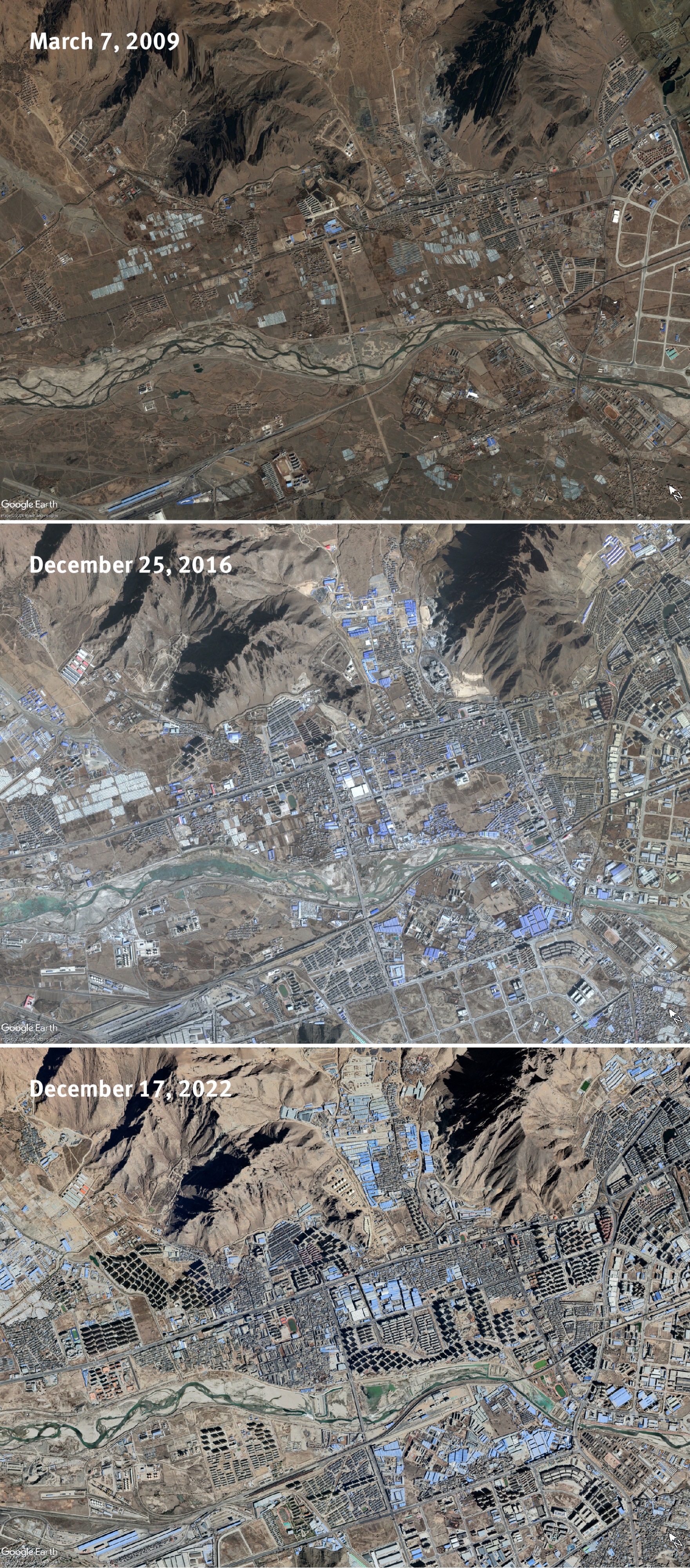
Satellite imagery showing urbanisation of the Sangmo village area in Tolung Dechen District, where several formerly nomadic communities have been relocated. Images taken on March 7, 2009, December 25, 2016, and December 17, 2022.
© 2024 Maxar Technologies. Source: Google Earth.