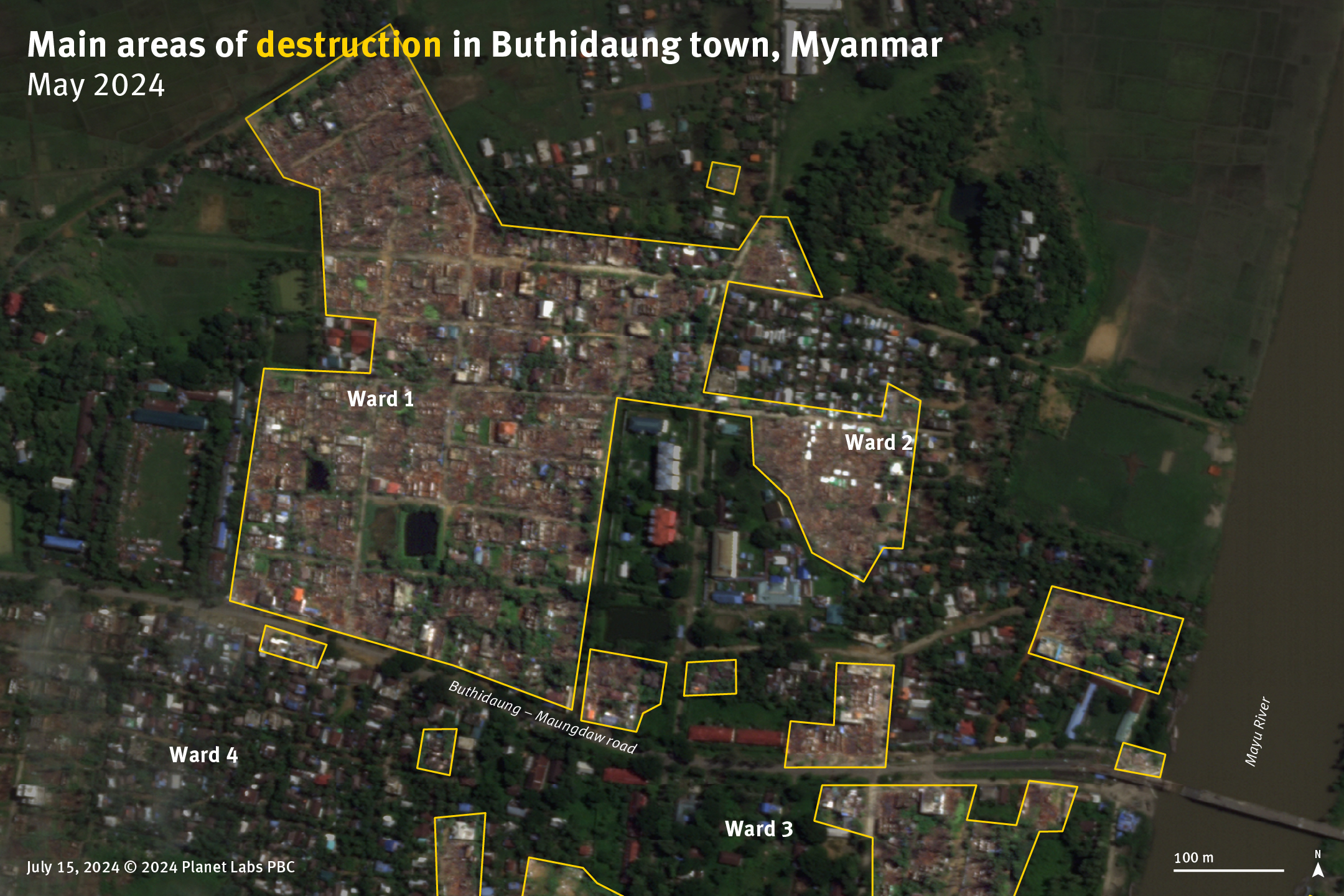
Satellite imagery from July 15, 2024, showing the main burned areas in wards 1 and 2 of Buthidaung town during the arson attacks from May 17–18.
© Planet Labs PBC. Analysis and graphics © Human Rights Watch.
Satellite imagery from July 15, 2024, showing the main burned areas in wards 1 and 2 of Buthidaung town during the arson attacks from May 17–18.