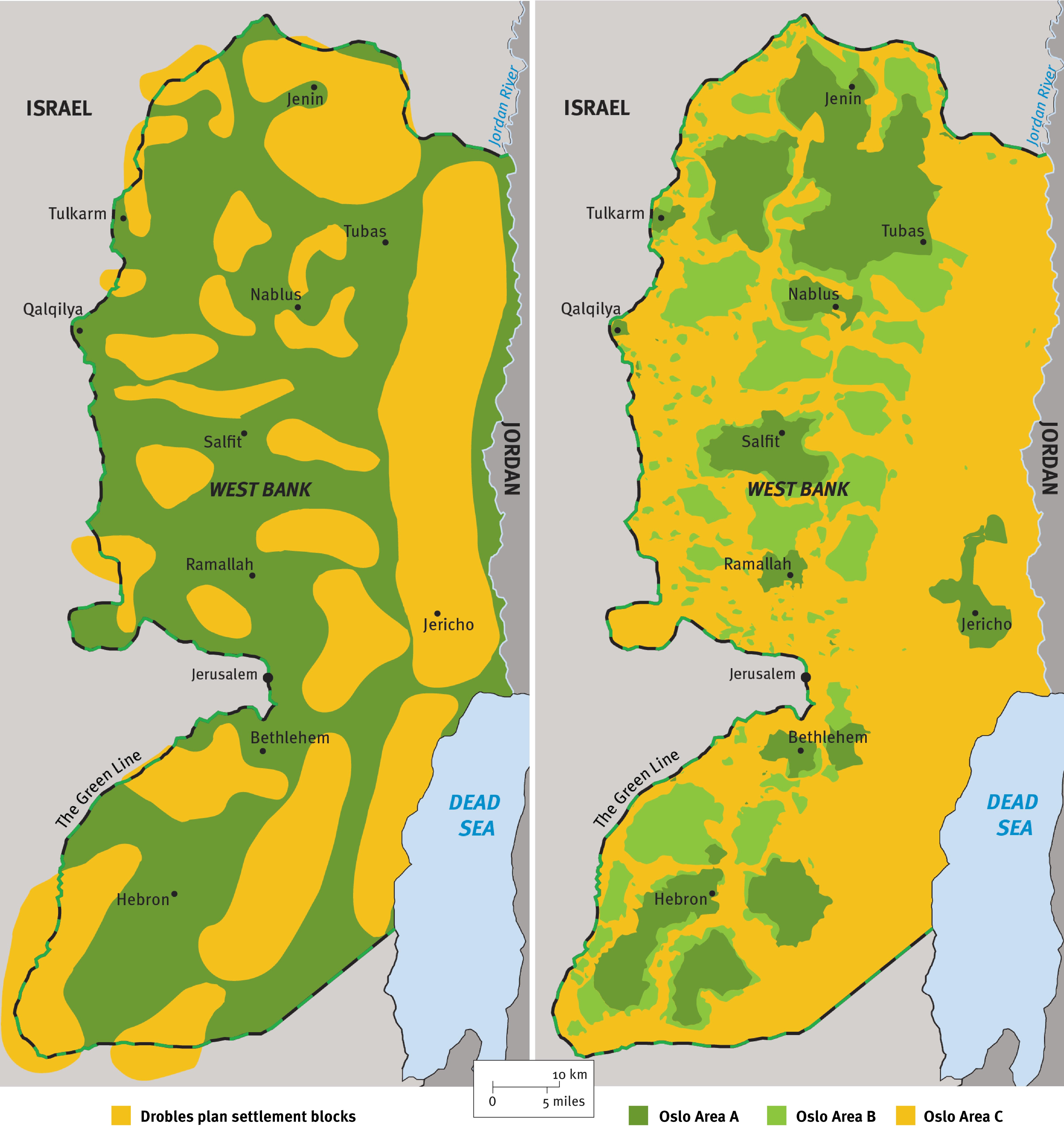
The maps compare the parts of the occupied West Bank that should be prioritized for settlement development under the 1980 Drobles Plan, which guided the Israeli government’s settlement policy at the time, and the division of the territory under the Oslo Accords of the 1990s between areas where Israel maintains full control (Area C) and where Palestinian authorities manage some affairs (Areas A and B).
© 2021 Mike King/New York Review of Books